Snow Day
Watertown Declares Snow Emergency, Schools Closed and Other Storm Impacts
|
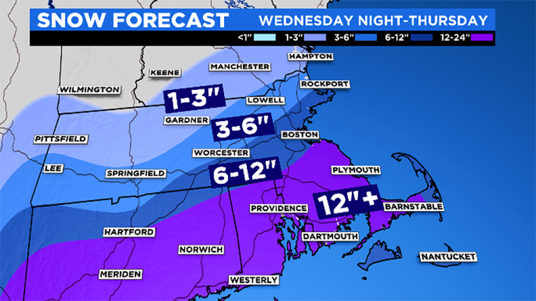
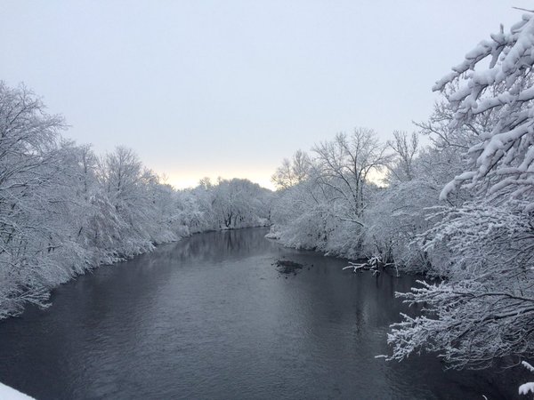
Snow covered trees along the Charles River in Watertown Square. The Town of Watertown has declared a snow emergency, which prohibits parking on public streets. The Town of Watertown announced other delays due to the impending snow storm that will hit the Watertown area from late Wednesday to late Thursday. The Nor’easter could drop a foot of snow or more the Boston area. The WBZ Channel 4 forecast puts Watertown square in the 10-16 inch band.